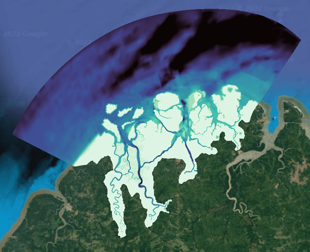
Mapping carried out to build digital terrain models of two areas in Paraíba, totaling 15 thousand hectares.
The Boqueirão dam was the largest topographic project carried out by Oceanauta, encompassing 11 thousand hectares and more than 100 km of river course.
///
Oceanauta
Planimetric aerial mapping of an area of 15 thousand hectares downstream from two dams in Paraiba