After the heavy rains that hit southern Bahia, we decided to use data from the Sentinel-1 satellite to determine potentially affected areas in the Jucuruçu watershed.
Watershed of the Jucuruçu River.
Through geoprocessing, it was possible to determine the affected areas until 12/07/2021 (initial date of the flood).
Flooded areas of the Jucuruçu watershed.
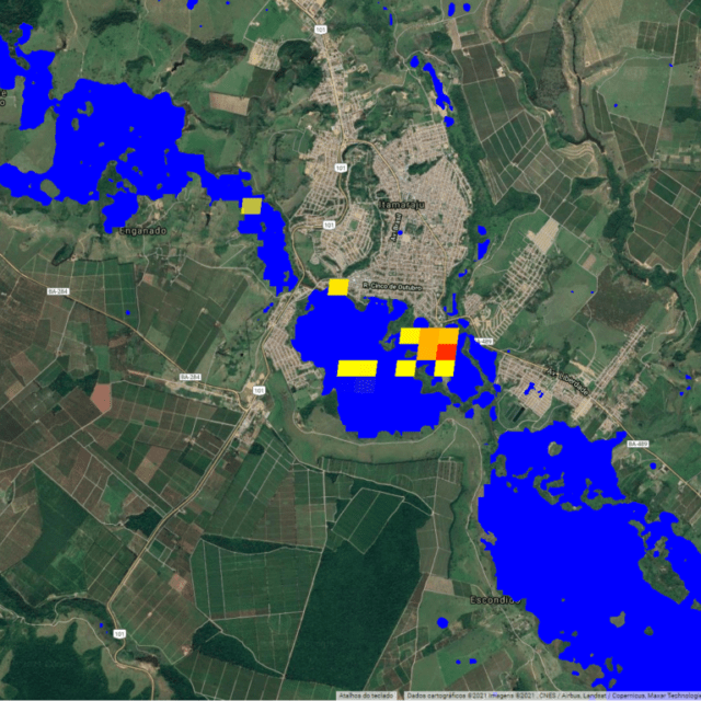
After a more detailed analysis, we found that the most affected area was in the municipality of Itamaraju, a region that has greater urban density and a naturally wider flood area.
Detail of the flood on 07/21/2021 in the central region of the municipality of Itamaraju – BA.
///
Oceanauta
Rainfall in Southern Bahia: A case study in the Jucuruçu watershed


